Showing posts with label motel. Show all posts

Monday, July 15, 2013

A Conspicious Lack of Industry

Tuesday, 16th April 2013

Map: Webster, New York to Sandusky, Ohio---342 miles

We breakfasted a la business class at the Hampton Inn---rubbing elbows with the suits, chatted up by the relentlessly cheerful staff.  We stood out in boots and plaids, and upon hearing of our journey one of the skirts behind the counter was ready to join us.

The first forty miles of the day was via Interstate 390 to Geneseo, New York.  Golden morning light made the rolling countryside attractive but left a stranger unprepared for the view driving into town on US 20A.  Cresting a low ridge, we suddenly came upon a long view dropping like steps over the farmland to the west.  It was very clear, and it seemed if it was just a bit clearer we would have been able to see all the way to Lake Erie, about sixty miles away.

Geneseo is a charming little university town threatened by its exurban status to Rochester.  It does seem to be striking a balance, though---with projects like the restoration of a beautiful old high school for university use.

West of Leichester we turned southwest on Highway 39, driving through rich farmlands to Castile.  The sky was rapidly darkening as we climbed a bit towards Bliss, where the countryside again broke out into a beautiful step down view.  Huge wind generators spun below gray violet clouds.  A large sign at someone's farm screamed NO FRACKING WAY.  Fracking is particularly contentious in New York state, where it's not allowed---while many farmers are reaping huge profits from it in Pennsylvania.

As we dropped down to Arcade, I tuned onto Radio Zoomer---CFZM 740---courtesy of the amplifying effects of Lake Ontario some 75 miles to the north.  Lake Erie would have the same effect on the signal, allowing us to easily listen in at up to 200 miles west from the transmitter---almost to Cleveland.

Spanish blue bells
I must admit I've lost the location of the following two photographs.  Nothing definite comes from studying Google maps, which has already saved me several times, but it's safe to assume this town was somewhere between Springville or Gowanda---although I'm not promising it's Collins.  At any rate, the Spanish blue bells in the lawns around town were fantastic, and the first sign of spring we had seen in four days. I was also duly surprised to see a rainbow flag flying off someone's porch, for the town seemed inhabited predominately by senior citizens.
A darker blue form of Spanish blue bells.

We dropped down into Gowanda, zigzagging through town and then along a charming Main Street.  It looked a lot like a movie set, and indeed it was used for the Steve Martin vehicle Plane, Trains and Automobiles (1987).  Less charming was a peculiar odor to the general area---like something less than wholesome cooking.  We never saw the source of it.

After pausing in the bustling city of Fredonia, we took a beeline side road under the New York Thruway and out to Lake Erie.  A light rain was falling now, draping the landscape with a dreary veil.  Still it was interesting for the thousands of acres of grapes, something a Westerner doesn't expect to see in New York state.  Wineries waited impatiently for the tourist season.
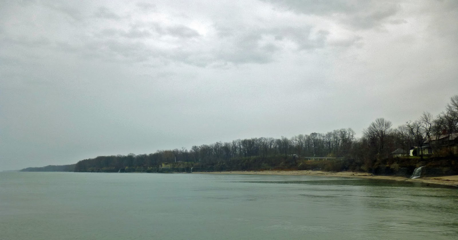
Looking east of the harbor at Barcelona, New York.
I served off and down to the tiny harbor just below Highway 5 at incongruously named Barcelona, New York.  Not that it isn't a charming little village, but it could never stand in for Spain.  Looking east, we could see waterfalls dropping into the lake.  On a clear day it must be a beautiful sight, but the weather didn't dampen our enjoyment of the scenery much.

We drove right through Erie, Pennsylvania on their Bayfront Parkway---through a waterfront redeveloped for pleasure instead of industry.  It's very attractive but feels removed from the city just above the bluff.  The parkway shifted back up into the city and then made it's way westerly through decades of suburbia and then exurbia on Lake Drive.  Lake Erie was never in sight, but the little farms and crossroads were attractive.

The lake came into view again at Conneaut, Ohio as we drove down Broad Street and right down to the little harbor.  The town had a sleepy, off-season charm---a far away feeling that I'm not sure would survive the warmer months.

Glimpses of the water, estates and parks passed by as we continued west on Ohio 531 through Astubula to Geneva-on-the-Lake, the latter a place to avoid at all costs during the warmer months.  On this cool overcast day it appeared to be an empty carnival---tidy and expectant.  Old trailer courts with vintage trailers vied for my attention midst the rental cottages.  Everything had the look of a long held tradition, largely ungentrified.  It's a prospective long gone way out West, where speculation and rapid expansion have no patience for such settings.  I'm glad I got to see it---on that day, not in high season.

We had to head inland to old US 20 at this point, and then west again towards Cleveland.  Old motels and half-forgotten crossroads made it an interesting drive, and I had long forgotten any worry of heading straight to the waterfronts of these big old cities.  After connecting to the old Lakeland Freeway and driving through a stretch of somewhat seedy old blue collar neighborhoods, the cityscape opened up again to a revitalized waterfront, clean and breezy.  All the factories were gone, with their attendant grit and grime, and the scene was expectant, proud.  Perhaps there's reason to be, but if this was an equitable world there would have been a compromise for the environment and our economy.  Fundamental goods like steel can be manufactured with less impact locally and globally rather than simply drawing a curtain over the poisoning process by moving it half way around the world.

Once past Edgewater Park, we connected onto Clifton Boulevard---very much a pleasant surprise.  Designed in a grand style some 120 years ago, it still moves six lanes of traffic along nicely midst wide tree shaded medians.  Upper middle class homes and apartments in Beaux Arts, Tudor and associated styles lined the way like dowager duchesses---maintaining their distance from the rush with quiet dignity.  They wore a patina of consistent maintenance instead of a new-found glory.  Children walked home from school, the youngest accompanied by both men or women.  It was an uplifting scene.

The boulevard narrows into Lake Road, lined with lakefront estates both old and new.  Occasionally a more modest house appeared, allowing the peek of the lake from around their small dimensions.  One, well maintained but giving off the air of despondency, was for sale---and I wondered how much it was worth, and how little the house would be valued in comparison to some McMansion.  The view from the street would be filled in someday soon.

There's a gradual shift as US 6 continues towards Lorain.  The estates are left behind, and then the twee small town feel of Avon Lake falls away to the dead end feel of old blue collar neighborhoods.  I know the name Lorain from circa 1930 ads for gas ranges---in particular, the Lorain automatic oven temperature control, which took the guesswork out of baking.  I looked around as we drove along, wondering where that factory was, but all there was to see were the largely lookalike houses and an occasional electric plant that lorded over all like face brick castles.  Major cross streets were empty of both commerce and traffic, but the town looked clean and respectable along Erie Avenue.

We checked into Knight's Inn on Cleveland Road on the outskirts of Sandusky---a motel with a common Google complaint of being noisy, but being off-season I assumed that would not be a problem.  Aside of the busy train tracks across Cleveland Road it wasn't, but the motel had a palatable spiritual vibration---a residue of running, thumping and splashing way into the summer nights, peaking at around midnight, when the Cedar Point amusement park would likely close.  It was easy to tune out, though---and the dirt cheap room was clean.

Rear of condemned fitted native stone block building, Sandusky OH
Driving on into Sandusky is interesting only for the plethora of dubious tourist attractions that vie for Cedar Point's traffic.  Gray sky met gray asphalt---yet that was more comforting than the aspect of a hot and humid summer's day.  Eventually this is passed by for old blue collar neighborhoods and a downtown trying to maintain its dignity, with fair results.  The waterfront, stripped of manufacturing, eeks out a living via ferry traffic, pleasure boats and fishing.

We came down to the waterfront to eat dinner at a fish joint recommended on Roadfood---The New Sandusky Fish Company.  It turned out to be as much a fish market as a fish fry place, providing a minimum of seating and ambiance.  That usually portends great food, but first we had to figure out what we wanted from the limited menu.  The man behind the counter bore a striking resemblance to my dead friend, right down to his plush beard and an expression as if I was trying to pull something off and not succeeding.  He looked over at my husband and then back at me.

"You can't grow whiskers like he can, can you?" he finally asked, his tone knowing but friendly.

I was taken aback, because my mustache is always ignored---I presume because most people don't say anything at all if they can't say something nice, let alone that it grows in the shadow of my husband's publicly revered, luxuriant handlebar.

"No-o," I finally replied, touching my throat.  It was a cool day, and my shirt wasn't unbuttoned enough to show my hairy chest. 

"My dad's the same way," he smiled---taking my no as an affirmative.  "He can go without a shave for a week and his face just looks dirty."

I smiled wanly, realizing that there was no gaydar going on---only a mirror image of his familial situation.  No use explaining that my beard is just has thick as his, although I was tempted to say Well, you ought to see my back hair!

Cedar Point from Sandusky's waterfront
We shared a combination dinner of perch and walleye out on a picnic table under occasional raindrops.  The fish was good, but not extraordinary.  As I ate, I recalled deliciously fresh and succulent white fish in Mackinaw City, Michigan.


Friday, June 21, 2013

Rude Reentry

Monday, 15th April 2013

Map: Saint-Zotique, Quebec to Webster, New York---264 miles

Dawn at Saint-Zotique, Quebec
A ruddy winter's dawning glowed through the unshaded windows of our fifty dollar once DeLuxe room at the Motel Rive du Lac.  I got up and went into the dingy kitchenette and inspected the stained Mr. Coffee before brewing a pot.  I handed a cup to my husband still in bed, and we sat and watched the colors warm and the waterfowl troll for breakfast.  Eventually the sun peeked over, and an orange glow spread westward over the dock.  I ran out in my nightshirt to photograph the scene and then darted back in, thankful that the heat had finally dropped out of space above the suspended ceiling and warmed our room.

Sunrise at the dock on the Fleuve St. Laurent.
The water was hot and shaving with the light behind me wasn't as annoying as I expected.  We packed Patsy Prius and headed out, passing a number of cars parked in front of the lesser rooms.  I wondered about their condition, and the price the guests had paid for them.

We planned to drive for awhile and then stop for breakfast, but not atypically we drove a lot farther than we expected before we found a cafe to stop at.  The border with Ontario was quickly reached, and then the mailboxes along Highway 138 slowly switched from French to English names.  Lancaster seemed as likely a place as any to find a meal, but despite a rather busy early morning appearance we saw nothing open at that hour.

The view from Summerstown, Ontario
Highway 138 returned to the edge of the St. Lawerence, swaying by retirement and summer homes.  The restaurants were still closed for the season in Summerstown, but the views were pleasing.  The water was so clear you could see the rocks on the bottom, and the lavender gray light painted the land and waterscape a nostalgic, bittersweet shade.

The name of the highway changes to Montreal Road as one nears Cornwall, so it was not surprising when we found ourselves in a neighborhood reminiscent of the French-infused cities in the state of Maine.  Twenty-four percent of the city's population claim French as their first language, although the commercial signage rarely reflects that.  It's a very bilingual way of life, where the public tongue is English and the private is French.

Prom Dresses: Babydoll drag or future mother-in-law's Dreamcicle chiffon.
My husband pointed out the King George Restaurant, a venerable eatery with its name awkwardly spelled out in gold face-brick, but I drove on---looking for something more interesting.  We never found it, but enjoyed circling back around and looking at the many old concrete block homes along the way.  The food at the King George was satisfactory but unmemorable, the view amusing from our booth.  We spent most of the meal commenting on the tacky dress shop across the street.

Unbeknown to us, the landscape west of Cornwall and continuing for some thirty miles to Iroquois was greatly altered by the creation of the St. Lawrence Seaway in 1958---but I did notice the whole stretch looks like a tidy, well planned rural roadside commercial and residential district, circa 1960.  Towns were wholly or partially submerged by the project, and relocation efforts were conducted by an international design competition.  Historic buildings were moved to a site called Upper Canada Village, a living museum.  Now the consolidated villages of South Dundas has a museum quality themselves---removed from through traffic by the Macdonald-Cartier Freeway to the north, they sleep until summer.  In the 1990s Ontario removed the provincial highway designation from the main road we drove on, providing an even deeper sense of isolation to the the low forest and islands.

The ubiquitous McIntosh apple was discovered in 1811 at nearby Williamsburg, Ontario---growing midst a thicket of second growth forest at an old farm.

The Iroquois Locks on the St. Lawrence Seaway
At Iroquois my husband wanted to detour to see one of the seaway locks on Harkness Island.  An adjacent park and huge parking lot suggested it was once a popular tourist stop, but the rough asphalt and the fact that the gift shop was for sale indicate it is now low on the scale of interest.  We stood there for awhile, I recalling learning about the Erie Canal and St. Lawrence Seaway in high school---wondering if that kind of history of commerce and transportation is even covered anymore.  Nothing happened while we were there---I suppose that shipping also has a season, just like tourists.

The countryside returns to a full sense of history west of Iroquois.  Old farms nestle close to mid century modern homes along the St. Lawrence, and the towns of Cardinal and Prescott seem livelier. Perhaps this is because they're close to Brockville, an old and long upscale city once home to lumber and transportation titans.  Driving into town, the St. Lawerence is lined with magnificent old homes---turrets putting on airs in a reception line.

The dowager queens of Brockville, Ontario
Brockville was also our last chance to visit Canada's top tourist destination, Bulk Barn.  Since Patsy Prius's GPS is largely indifferent in Canada, we had to stop and ask a woman at a gas station for directions.  My studies of the store locator map that morning proved helpful---we were only a block away from the store.  Being that we were now in a British-esque province, I could find those delicious wine gums in the candy section---as well as other curious items, such as coconut flour.  However, I'd soon be lamenting the fact that I didn't buy enough of their high quality flavored black teas.

We were so intrigued by the glacially groomed, granite studded landscape on the old highway west of Brockville that we failed to see the short and easy connection back to the freeway and the border crossing into New York.  So with irritation as the waste of time and the trepidation of impending annoyances, we continued almost to Ganonoque before making the connection and then headed back to the Thousand Islands port of entry.  This border crossing is very touristy---a plus at that time of the year, since there are no tourists.  Only one car was ahead of us, and they soon passed through.  Of course this meant the agent would be on the rather bored side and may pull out all the stops on interrogation.  Our passports were handed over, our relationship lied about.  One is never sure how to answer that question when your country doesn't recognize your marriage but your state does; however an agent has never countered our assertion of being friends, either.  I'm under no delusion of privacy.  Someone that spends more time looking at a computer screen than your face has much more information on you could ever give him off your cuff.  He typed and read a little more and then said:

"So you're telling me that you drove all the way across the country just to spend two days and nights in Quebec..."

If I was in the driver's seat I would have given him a Zsa Zsa Gabor bitch slap, but I only glared off into space as my husband once again went into even more details of who we visited along the way.  This kind of government mandated insolence is just disgusting.  If I was trained for violence, do you think I'd crumble under such obvious machinations?  Eventually he and/or the computer was satisfied, and he handed back our passports and lifted the gate.

"Welcome home," he said a bit too cheerily.

Oh, fuck off.

My husband drove on for another grumpy twenty miles through the most unwelcoming part of upstate New York.  The farms along New York 180 have gone feral; the old homes imploding and the mobile homes exploding from either social or chemical disaster.  Tourist services were weed choked.  It was a shock after being in Canada for several days, where the countryside always displays a veneer of respectability, if not good taste.

We switched drivers down at the old mill stream in La Fargeville and continued south southwest through an improving landscape on New York 3 and 104.  Unfortunately there's no through roads along or very near the shores of Lake Ontario, and there's a distinct feeling of missing out on something when the lake is occasionally seen from afar.

At Webster we splurged on accommodations at the Hampton Inn---mainly because there was nothing cheaper that didn't have a bad reputation.  I find this kind of generic luxury interesting---I can see the appeal of the predictability of it all, and at the same time how it isolates the guest even more from the community they're staying in.  It would be easy to stay in such places every night and drive the Interstates all day and have nothing to say for yourself except that you slept very well.  Which, of course, we did.

We had family diversions on my husband's side in Webster, though---nieces and nephews grand and otherwise, not to mention their better halves---half of whom I only had acquaintance with via Facebook.  We met at one's rented farmhouse---a virtual time capsule of a post war remodel of a circa 1900 house, save for some Carol Brady wallpaper in the kitchen.  Via my postings on Facebook they knew I'd be enthralled and chatty about the details---right down to the wall tile in the bathroom, which I declared looked like the advanced stages of colitis.  The ceiling was ultra-coved into a tunnel effect and covered with gray subway tile---essentially giving the feeling of going under the Hudson or walking into some Automat shrine.  The basement was a maze of storage and somewhat sinister prep areas for the turkey operation the farm once was.

Nieces and nephews---grand and otherwise---and their significant others.
We carried on our revelry and frank observations down the street to the local Red Robin, where I considered a cocktail but settled for caffeine.  It was a thankfully quiet night there, so we could hear one another and mostly just disturb the staff.   Our ginormous fresh salads pleased both me and my husband---he so much so that he thought it was a worthy stop four days later.

But that's another story.


Tuesday, May 21, 2013

Snow and Sun in Quebec

Sunday, 14th April 2013

Map: Quebec City to Saint-Zotique, Quebec---246 miles

It had snowed again overnight in Quebec City, but since it was a couple of degrees Celsius it was not sticking to the pavement or sidewalks.  West southwest at Montreal it was already partly sunny, so we didn't expect to have problems driving in that direction.  And we didn't---although it was a bit dicey after we got of Autoroute Felix Leclerc and drove into Saint-Augustin on Quebec 138.  It was snowing heavily there, and had been doing so for quite some time, judging by the slushy highway---but Patsy slogged on through without mishap.  The snow soon stopped falling after that, and for a couple of hours thereafter it was merely a dreary winter's morning.  We drove in the opposite direction when Patsy was new some nine years ago, but since that was a late May day and the road was clogged with convertibles and motorcyclists enjoying a warm weekend it was hard to match up anything from that day.  The naked trees and flat gray light made it a different place.

I did recall at Donnacona that last time I had missed the turn for the old alignment through the heart of the city, so I made the point of taking it this time.  It was so dark that some of the street lights were on, and a few people moved about for coffee and donuts before church.  I didn't make it through the most interesting part of town though, as the bridge over the Jacques-Cartier River was closed for renovation.  We had to wander through tacky 1960s-70s residential streets to again connect to Quebec 138.  Donnacona was once a thriving pulp mill down, so these homes reflected the middle-class aspirations of the time with designs more often reserved in America for dentist offices or similar professions.  Think of wood siding on the diagonal and soaring roof lines with clerestory windows, or glittering panels of crushed white offset with pink or aqua siding.

Eglise de Saint-Francois-Xavier at Bastican, Quebec
Gradually the gray lifted over the fallow fields and murky Fleuve St-Laurent, rising higher and higher until the sun burned through from time to time.  I stopped to catch the silver sun shining off the typically silver steeple of the Église de Saint-François-Xavier at Bastican.  By the time we reached La Pointe-du-Lac, there were patches of blue to match a cheerfully purple Quebecois cottage.
Atypical color for a typical Quebecois cottage.

From La Pointe-du-Lac we could see a cold copper peak on the horizon along the St-Laurent, evidently a cathedral with a very broad skirt around it, like a witch's hat.  As we rolled into Cap-de-la-Madeleine we could see it peeking around houses and trees, so it was obviously a worthwhile detour.  Up close Sanctuaire Notre-Dame-du-Cap is a stupendous basilica in the round---and although officially Norman-Gothic in style, it also displays liberal applications of Gothic Moderne and Mid-Century Modern.  It's theatrical to the point of being campy---otherworldly enough to stand in, with appropriate props, as a Siamese temple.  When consecrated in 1964, it must have symbolized the advancement of the Catholic Church into the Brave New World---a world it has since retreated from.  Compared to the latter-day jail-like Our Lady of Angels in Los Angeles, Our Lady of the Cape is an exuberant celebration in trying something new.  Since Sunday mass was in progress, we didn't see the interior---which photographs as properly solemn yet grand.

Would Cecil B. DeMille approve? (Google Image)
It was all an escape from the gluey stench of pulp mills and chock-a-block brick tenements that more or less remain to this day.  We wandered through these, trying to connect to Autoroute Felix Leclec to make some time west through Trois-Rivières.  We continued for forty miles through more fallow fields and naked, stunted forest---all made duller by the lack of something humanly quaint or crappy to focus on.  Studying the motorists passing us by on the left and the sky were the only forms of entertainment---blue billowing gray and white.

We exited at Berthierville onto Quebec 158 and headed south and west across the prairie to Joliette.  Farms and their upturned bathtub shrines for Mary provided interest, as well as my perverse need to drive into the center of cities to see what there is to see.  At Saint-Lin–Laurentides I didn't even have to go astray, as there was no other way to proceed except through the heart of the scrappy old town.  We sat in post-church services traffic, witnessing some very unchristian like behavior.

A few miles before Saint-Lin–Laurentides we passed a syrup house restaurant Des Erablière Aux Rithmes (The Seasons of the Maples), also very popular with the church crowd despite a rather disreputable road house look.  We considered stopping for lunch, but it was so crowded we drove on and eventually settled for a pedestrian meal at Subway in St. Jerome.  My husband said he had a hard time recalling all the names for vegetables for the making of our vegetarian sandwiches---and the slightly slangy, indistinct French spoken by the teenagers was sometimes confusing.  In retrospect, I wish we had braved the crowd and had a more interesting dining experience.

The ProLite Eco twelve foot trailer.
St. Jerome appeared to be still under the affects of a hard winter, as mountains of dirty snow filled vacant corners on the gritty south side of town where we had stopped.  We drove through downtown, which was marginally nicer, and then out to the light industry area just west of the Autoroute des Laurentides to visit the Roulette's Pro-Lite trailer factory.  Their little showroom was packed with folk putting a down payment on springtime---it was not the quiet scene we were expecting.  We waited for the salesman my husband preferred---perhaps he was picking up on some homophobia from the other, but in a crowded room resonating with a different language I was pretty much shut down and just tried to stay out of the way.  We noted the improvements on our favorite 750 pound model over the one we saw last fall in Salmon Arm, British Columbia, mainly sleek frameless windows and LED lighting.  Eventually the preferred salesman was available---very pleasant and smooth, and segueing between French and English effortlessly.  Of course he complimented my husband's French, and without fuss jotted down the prices on their little glossy catalog and gave it to us.  Twelve thousand dollars, minus a couple hundred at the current exchange rate.  We could take five similar month long road trips like the one we were on at that moment for the same price. In spite of all the driving/travel we do, we'd be hard pressed to really get our money's worth out of a new trailer.  If we bought at all, we'd follow the suggestion of the salesman and go for the occasional trade in.

We spent the next hour and a half traversing the autoroutes in and out of Montreal sprawl and out towards Sallyberry-de-Valleyfield---only to hastily exit when we realized the freeway bridge over a section of the St. Laurent had a toll.  We made our way down to the old bridge and crossed directly into suburbia and Canada's greatest tourist attraction: Bulk Barn.  Long a cultural icon in Ontario, it has only recently moved into the Far West (British Columbia) and its closest neighbor, Quebec.  We have found that the stock varies from store to store---here they presumed Quebecois would not be interested in British Wine Gums, that delicious not too sweet confection akin to Gummi Bears.  Oh well, we'd just have to stop at the Bulk Barn in Cornwall, Ontario the next day.  Meanwhile there was quality bulk teas to stock up on, different cocoas---coconut flour, hmm---something interesting to bake with.  The cashier was a teenage girl with an OMG attitude and high-pitched voice my husband could not understand.  Being a new store and new on the job, she sent the store's pretty boy off  a couple of times to find the price code on several items.

We retraced our route, crossing back over the St. Laurent on Boulevard Monseigneur Langlois and then west on Quebec 338 to Saint-Zotique.  Our bargain basement Priceline room for the night was at the riverfront Motel Rive du Lac, a rather shabby looking midcentury modern building of glittering granite blocks.

"How did we get this room for fifty bucks?" I asked my husband as he directed me to drive right up to the water.

I opened the door to our once DeLuxe waterfront apartment and immediately saw why it was only fifty bucks.  The new goldenrod paint did not hide the fact that these were distressed accommodations furnished with thrift shop furniture.  At least it was reasonably clean and the mattress comfortable.  The battered kitchenette was overstocked with garage sale items, the bathroom sink had no mirror over it---one had to turn around to shave in front of a mirror on the opposite wall.  I turned the heat on and found the heater was hidden above the suspended ceiling, so we probably roasted the manager's apartment upstairs before we felt anything.  Best of all were the homemade drapes on homemade flat rods that made it nearly impossible to draw them back.  We tugged and yanked and propped them back with whatever was handy so we could reveal the picture windows and the million dollar view.

One of the views from our once-DeLuxe room at Motel Rive du Lac
There.  Just look outside.  The weather had cleared enough to offer beautiful skies and far views.  The water changed colors as the sun went down, and suddenly the light caught the windmills some fifteen miles across the water and up on the hills to the south.  For a few minutes I watched the long, undulating line of them spinning in the wind, and then the light sank into twilight and then night.  The windmills winked red---sometimes in waves, sometimes in florid disharmony.  We never drew the drapes.


Tuesday, April 23, 2013

374 Miles to Tibet

Thursday, 11th April 2013

Map: Bordentown, New Jersey to Burlington, Vermont---375 miles

A cold front broke the heat of the preceding day, bringing a thunderstorm overnight and a cool, gray fragrant morning.  We avoided Trenton by driving the I-295 beltway, which so skirted the city that we were left with no impression of it.

Peeking into a Princeton, New Jersey garden.
US 206 took us north through Lawrenceville and Princeton, both towns very much in the New England manner, with narrow streets and beautiful old homes.  Princeton is especially twee, the homes large and often placed well back from the road.  Spring was especially present in their accompanying old gardens.

It was much more a modern suburban view through Belle Meade and Somerville---still interesting in its mix of rural farms, housing tracts and shopping malls.  Unlike the rest of America, there seems to be no planning for the increasing volume of surface street traffic; the roads remain narrow and without shoulders.  Only the crossroads receive any real attention due to high volumes of traffic crossing each other and stores.  Being mid-morning, the traffic was light and the driving easy.

Sri Venkateswara Hindu Temple, Bridgewater New Jersey.
There's a stretch of US 206 that becomes a modern, wide boulevard in Bridgewater.  Just beyond the Aventis Pharmaceuticals plant we came upon this tasty wedding cake: the Sri Venkateswara Hindu Temple.  Not only did it demand to be photographed, it held a sort of aura of anticipation.  A sign listed a rapid progression from the recent past to the near future---when landscaping is supposed to be installed.  I hope it's exotic as possible and complimentary to the temple.  On Google there are many praises for their cafeteria---and not unexpectedly, a retort, saying one goes to temple to be with God, not a cafeteria tray.
  
The siting of the temple was also a strange forbearance of how the day would evolve...

At Chester, a local tourist shopping destination, we decided it was time for Dairy Queen---but found it strangely closed well past its posted opening hour.  The better alternative of local ice cream down the block was met with a chortling generator at the door: fire in an upstairs apartment had made the building uninhabitable, and they were trying to salvage the ice cream.  Hey, just give us a spoon!

So the quest for ice cream was on.  Patsy lead us astray in Flanders for a Dairy Queen in Mt. Olive Township---only to find a local eatery had superseded DQ in the last ten years.  At least the detour was interesting.

Just outside of downtown Stanhope we passed the very pretty Lake Musconetcong surrounded by old once vacation homes.  A few miles up US 206 in Byram Township there's Cranberry and Panther Lakes, along with several others beyond view.  The granite outcroppings and broadleaf forest complete a very picturesque setting, so it's no wonder that this was a premier vacation destination served by the Lackawanna Railroad a hundred plus years ago.

After jogging through downtown Newton, we finally came upon a vintage Dairy Queen---where we indulged in the Blizzard Flavor of the Month: Chocolate Covered Peanut Butter Pretzel.  The middle-aged woman behind the counter must have been new, as she wanted it to be just right: Chocolate or Vanilla ice cream?  No one had ever asked us before, although on rare occasions we'd be handed a Blizzard made with chocolate ice cream, and it was always way too much of a good thing.

"It has peanut butter syrup in it, is that okay?"

We nodded.  This was becoming quite a process, but she did produce a perfect product---not too sweet, with a nice salty/crunchy note from the pretzels.

"Do you do senior discounts?" was my husband's usual question.  One would think we'd have a free day from all the discounts he requested on this trip.

"Um, let me check."  She went back into the kitchen and then returned.  "Yes, we do---but be sure to ask, because not all the girls know that we do."  Meaning her.

Since this vintage DQ had no indoor seating, we leaned against the south wall of the building---sharing the Blizzard while watching others eat their nasty food in their cars.  The weather had chilled considerably as we headed north, but the south wall provided a warm spot to eat ice cream.

North of Newton we veered off onto New Jersey 94, which brought us over the New York border to the rather chic if not rather sparse year around resort of Warwick.  We continued on towards Newburg on the Hudson River when I realized I or we or someone had made a grave error.  Within seconds it wouldn't matter who did it.

My husband was consulting the map, and I poking a finger at it as I kept one eye on the road.

"Here.  Burlington, Vermont," I snapped.

My husband squinted at the atlas, flipping between pages.  "Burlington is way up here."

It is his job to make motel reservations, which we were now doing just a day in advance to avoid driving into weather problems.  I must have said Burlington.  Shit.  Burlington, Bennington---let's call the whole thing off.  He had shown me the online map accompanying the reservation, but it was too focused on the motel for me to notice my mistake.  Yeah, whatever.  Thanks.

Now of thoroughly foul mind, I handed the wheel over to him and he drove us into Newburg---which was also thoroughly foul, slummy and larded with unsynchronized signals.

"Forget Poughkeepsie," I ordered as I studied the atlas. "We've done it more than once anyway.  Cross the Hudson here on I-84 and head for the Teutonic Parkway."

I always call the Taconic State Parkway the Teutonic because who the hell knows what Taconic means anyway?  Of course once one starts saying Teutonic they recall Joan Crawford in blonde braids doing a jig in a beer garden with Fred Astaire in Dancing Lady---and a mental breakdown is imminent.

Okay, okay.  Deep breath.  Let's focus on the God-given graces of the Taconic State Parkway, 104 miles of graceful if not lumpy hills and curves---which so happened to be about the same as the extra miles we'd now have to drive to reach Burlington, Vermont.  Actually, these were graces designed by landscape architect Gilmore Clarke to offer an atheistically pleasing yet timely road trip through the eastern Hudson Valley.  The parkway bond, a pet project of then governor Franklin D. Roosevelt, was passed in 1925, and construction began in 1931 at Valhalla as an extension of the Bronx River Parkway.  In a radio speech during the opening of this first segment, Roosevelt envisioned the parkway reaching all the way to the Canadian border, but the Taconic was considered finished when it finally reached the Berkshire Connector of the New York State Thruway in 1963.

We drove the last 64 northerly miles of the Taconic State Parkway, starting on a segment that was completed in 1935.  Ten more miles were opened to Highway 55 in time for now President Roosevelt to drive the Taconic to the 1939 New York World's Fair.  World War II halted construction, but another twenty mile segment was completed in 1949.  All of these segments balance beauty with speed, the narrow dual lanes and lack of shoulders heightening the illusion of the latter.  The views, even on an ever increasingly dreary day, are quite spectacular.  The post 1949 segments reflect advancing views on highway engineering and are somewhat less engaging to drive---more akin to a modern Interstate.

Of course I'm not going to pay a toll when there are more interesting alternatives, so we exited just before the Thruway at Chatham, moving onto 295 and headed east to 22.  This highway travels north through narrow valleys dotted with often forlorn farmhouses and quaint if not comatose little towns.  At Berlin Patsy's yellow snowflake came on---meaning it was 37 degrees outside, a full thirty degrees cooler than it was when we started in Bordentown that morning.  Spring had receded in the same fashion, now noted only occasionally by the earliest bulbs.

Highway 22 zig zags through charming Hosick Falls, once home and burial place for folk painter Grandma Moses.  I was going to suggest she was the Thomas Kinkade of her day, but aside of her comparable celebrity her brand of sentimentality was based on experience, not fantasy.  Both artists thrived in their era of war and social change---Grandma Moses's celebrity kicking off just as Europe went to war in 1939 and peaking during the McCarthy era.

We were now just 15 miles due east of Bennington, Vermont---but still 117 miles south of Burlington.  I had resigned to our fate, being too tired to do otherwise.  Besides, the radio was suggesting we were doing a good thing---heading as far north as possible, ahead of the snow.  The scenery was winter barren but pleasant; even the crocus had disappeared.  With a good highway ahead of us and few towns to slow for, we could make the trip in about two and and quarter hours.  Driving into a sleety squall lengthen the drive to two and half hours.

Once we passed through the squall, the skies lifted to high winter overcast, with golden breaks to the west behind the Adirondacks.  North of Shoreham, Vermont the scenery became expansive, with farmlands rolling down to the southern end of Lake Champlain and rolling back up to the snow covered mountains.  It's very pretty country, a place to stop and explore sometime---when it's warmer.

We were listening to Magic 590, WROW---its high fidelity signal traveling clearly through the cold atmosphere from Albany, New York.   It's one of those stations that try to please everyone by playing most anything from 1950 to 1980, although I imagine folks hardly older than myself don't appreciate being bundled into their parents or even their grandparents generation.  I'm merely amused, and in this case appreciated that WROW actually has local people behind the mikes regularly giving out real traffic and weather.

A song came on from my extreme youth---one that, on the surface, inexplicably moves me.  For casual purposes I can explain this away with the fact that I did not have television from the age of six to fourteen, so the radio and the popular story-telling songs of the 1970s had an indelible impact on me---but as I grow older I understand the impact was more about a subliminal precociousness, if there are such things.  In that I'm referring to situations lost and forgotten---adult themes in the need of replaying, resorting and restoring to proper context.  It feels like a delicious sort of mourning.

Now, as I write, I have to go back and research the song because my memory of music is like a child's---based on rhythm and emotion, not titles and artists.  My connection to music remains so after forty years; my mental jukebox buttons are always in need of a cipher.

Perhaps the song was I Go Crazy.  The title is suitable enough, and right now I can't spend more time researching.  I can't spend more time in the nauseous space I arrive at via an analytical approach.  As we drive along I'm not ten or even twenty but merely a man advancing in age, and for the moment, open.  A now-dead friend has dropped in for a visit.  Friendships evolve so much after death, after convention drops away---and here he is, just dropping in for a loving moment---a reminder not to resist the moment.  I feel his curls and his skin and then he is gone.

Ah, but resist I must, for I've been trained well.  Now we were turning into the G.G.T Tibet Inn of Burlington and I was wondering what the hell my husband has got us into now.  He had been pronouncing Tibet as Tibbet, so I had no idea we were going to spend the night in some third world shrine.  However, the Tibet Inn turned out to be a clean, comfortable and ordinary if not dated motel run by friendly Tibetians in exile.  Their explanation of the curious G.G. T.: "Gangjong Gesar Tsang is a name for the Tibetan homeland. Its meaning is roughly “land of the snows,” and it is used by Tibetans to mean their spiritual and emotional home, rather than the political nation of Tibet, Phoe."  More interesting things can be found out about Tibetians in Vermont at G.G.T. Tibet Inn, and I was very glad to help them.


Sunday, March 31, 2013

...And Put $30 In The Bible

Friday, 29th March 2013

Map: Ely, Nevada to Springdale, Utah---257 miles

We breakfasted at the Silver State Cafe in Ely, although I really should have known better.  A rather lousy veggie omelet from years ago came to mind, as well as high prices.  I'd stick to a special this time---or it would stick to me, as it turned out.  Our eggs and solitary biscuit came from either Reno or Salt Lake.  The other apparently never made it.  It was a $3.95 Special for $5.49.  Note to self: The Hotel Nevada can't be as mediocre as this

“Out at Silver Valley?” an old man nearby spoke into his cell phone.  I found myself listening to him because unlike most cell phone users he spoke softly.  I took another bite of biscuit with floury sausage gravy.

“Yeah, we’d be better off burning coal,” he continued.

Looking east into Silver Valley on US 50 at US 93 South.  Mt Moriah to the left.
 And here we are, thirty miles east of breakfast---gazing across Silver Valley.  I always found it stirring in the morning light, the grand sweep between 13,000 foot Wheeler Peak and North Schell Peak to the northwest---the valley rising to the north like a wave from the past.  This morning Mother Nature is on a break.  It is still, and a forlorn haze veils the snowy mountains.  There is one new man-made feature in Silver Valley, the only one that stands out besides US 50---America’s Loneliest Highway.  It is a cluster of huge wind turbines, as still as the mountains.

I’ve only been here in the morning, and wind is not part of that memory.  The energy is all in the low light, sweeping in from the east and cutting out the landscape to the west.  But we’ve always taken from this part of the Nevada and moved the goods to supposedly better places.  And so we turn south on US 93, driving into the intolerable haze---an opaque proposition that doesn’t merely stand sentinel or craters the earth but literally sucks it dry.  Vegas, baby.  It’s Manifest Destiny, baby---and it’s thirsty.

What water?  The olive juniper and purple sage are mute---our nasty introduction, cheat grass, feigns a crisp golden silence.  Only a broad swath of burnt skeletons speaks of the present, only the name of the valley we drive into speaks of the past: Lake Valley.  The lake---more of grass than water---has sunk underground, and will continue to sink no matter who signs the damned if you do, damned if you don’t contracts.  Ranchers, ground down by drought, cheap beef and the whir of their pumps will be replaced by bigger pumps---and those who remain face an uncertain future, the water underground migrating to the highest dollar via a 263 mile pipeline.

A sign points to Atlanta that away.  There’s the water, towards the Utah boarder.  Sign here, governor of that state, or forget your rights to a share of it---forget your right to even protest.  It’s all here in print, but the politicians are simply turning the page.  The voters, smug in their sprawl, don't care anyway.

The sun rises higher, and the air slowly stirs.  White clouds start punctuating a bluing sky.  Dutch John Peak rises alone on the horizon, the ribbon of highway undulating over his flanks.  Ruggedly handsome, snow white on top, the old man is both green and burnt.  A photo opportunity, but there’s no shoulder to pull off on.  My eye trains along the edge of the road, searching for width but only finding bottles and cans glinting in the sun.  We pass the old man by.

Looking north into Pioche from old US 93.
Something new shining in the sun.  It is our own past; it is Pioche---the first town in 108 miles.  It was also our first stop in investigating this part of Nevada some dozen years ago.  The only apparent motel in town was full for some reason---who cares if it was a Friday. 

“They’ll have a room at the motel up the road a ways,” said the proprietress.  “You can call them from here.”

Having come from the south, we didn’t realize there was another one the very northern edge of town.  My husband said: “Oh, we’ll just drive there.”

“Oh, you can’t do that,” she explained.  “You must call.  And I’ll tell you what to say.”

She waved him into the lobby, dialed the number and handed over the receiver.  “When she asks if you’ve been there before, just say yes.”

An old lady picked up the call, said she did indeed have a room and took down our address and phone number.  My husband could hear the turning of pages over the line.

“And you’ve stayed with us before?”

“Yes.”

“Then you know the procedure.  The key is under the door mat and leave thirty dollars in the Bible.  You’re room number 3.”

“Thank you.”

My husband handed the receiver back and the proprietress smiled like the Cheshire cat.

The motel was of the 1930s---white clapboard, tidy and tiny.  The rooms sorta grew out from one another, and our double bed practically filled ours.  A defunct 1950s console television stood in the corner, taking up the rest of the room, and a modern television sat on top of that.  I was rather surprised there was even television provided.  The real amenity was out back: a rocky ledge jutting out over the desert---a quiet place to sit and take in the view reflecting the setting sun.

It’s still there, although the cheap 1970s era yellow plastic sign has faded to almost illegible.  A closed sign was tacked up to one corner of the building---closed forever or for the season?  Maybe the closed sign was there even when we stayed there.  The old lady would be ancient now, but the place and adjacent owner’s bungalow still looks tidy.

Pioche seems tidier than before.  The little Gem Theater with its 1940s neon marquee is closed---now playing is simply a thank you.  The other shops on Main Street look to be in business, although in all the town seems quieter this Friday than the one a dozen years ago.  There are some interesting houses, but none on the fancy side.  This was strictly a miner's---with shot gun cottages, bungalows, trailers and discordant modern vacation/retirement homes clinging to the hillsides.  The view to the north is spectacular.

Faux granite block house in Caliente.
We glided past Cathedral Gorge and on down to Panaca, but instead of turning left to head to Utah we took a 15 mile detour down to Caliente to see a faux granite block bungalow for sale for $53,000.  We saw it on the internet, of course, and since we have an affinity for vintage block houses we made the trip.  

Caliente is definitely desert.  It's about two thousand feet lower than Pioche, with colored canyon walls rising all around it.  It’s the only place with city services outside of Cedar City, Utah, a hundred miles distance.  There’s a newish small hospital on the north side of town and a supermarket of sorts on the very forlorn and ancient business block along the railroad tracks.  A large and beautiful mission style Union Pacific depot appears to be used now to house city business.  The town seems to be inhabited by folks who haven’t the money to get out of town and those who moved there so they retire to permanent Weekend Warrior status---meaning raising some desert hell with their motorized toys.

Some of this new concrete has got to go...
The block bungalow was charming, particularly since it appeared neither neighbor had dogs.  Keeping your eye above street level avoided the drab trailer across the street and offered a view of the colored canyon walls.  Although the ad said it was a two bedroom house, it really was only one.  From a few uncovered windows we could see the living room across the front of the house, a dining room and kitchen, and an alcove hall with bath and bedroom.  It had a full daylight basement with vestiges of a second bathroom.  It appeared someone did a lot of work to it, such as rewiring, and then lost it.  The large back yard was a major asset.

Touring around the neighborhood, we saw another great house for sale---a tan baked brick bungalow on a very large corner lot.  The porch featured two front doors---one to the front bedroom, a common feature in railroad towns, where homeowners often rented out a room to railroad workers.  It appeared very original, but online consultation revealed some interior desecration---particularly an offensive 1980s kitchen with Formica Island.  It was a much larger house than it appeared: 3 bedrooms/2 baths/1600 square feet.  Built in 1935, it was in the Craftsman style with some Deco touches---such as the three banner style to the glass on the front doors.  Price reduced to $110,000.

We returned north to the crossroads to Panaca, a dessicated once Mormon oasis, and seeing a late Victorian block house wandered around the few streets, looking for others.  We found two.

Nevada 319 climbs to the Utah border through a lush, short juniper forest.  The views to the north are expansive.  Dropping over into Utah, the landscape thins, the highway joins the Union Pacfic and a few foundations and an imploded vintage trailer mark the site of Uvada.  Eight miles further northwest is the living ghost/railroad town of Modena.  The modern highway skirts the to bridge the railroad, giving the passerby a overlook at a handsome stone school, a fire house that appears to be remodeled into a residence, an abandoned hotel and a few old houses.  I rather regret not backtracking on Main Street once we crossed over the tracks.

Utah 56 veers east southeast across broad high plains dotted with old ranches and newer and rarely more successful ranchettes.  The number of buildings gives the impression of considerable population, but I doubt many are year around residents.  Spotting vintage trailers is one form of entertainment---they seemed to be the first form of homesteading, and sometimes more substantial than the buildings that replaced them.  Failed irrigation is marked by half dead fence rows.  At Beryl Junction the c. 1950 schoolhouse long ago turned into a general store which long ago closed.  Vintage cars and trailers fill the playground.

It's another ten miles to a modern gas station/mini mart at the cross roads to Newcastle, another thirty miles to Cedar City.  A swath of vivid red on the spectacular mountains that rise above town is the first impression of the basin, but then there are endless huge warehouses and finally the towering signs of commerce vying for attention.  I found sudden civilization irritating, as I do most of the I-15 corridor in Utah.  Rapid development in the last twenty years has pretty much destroyed a sense of individualism to the area.  Cedar City sharing a newspaper with St. George fifty miles south and three thousand feet lower is a perfect example of this modern homogeneity.

Cougar Mountain north of Highway 9, Rockville

Springdale.  The Sentinel to the left, Twin Brothers to the right.
Somewhat soothed by a Dairy Queen Blizzard (flavor: Heath Bar), we continued south on that mad rush that is I-15 past the beautiful Hurricane Cliffs and then a fast drop into the heat at Toquerville.  There are some cute old homes in town, and redbud trees flared like hot pink torches in the yards,  but the whole surrounding locale is being subdivided into lots and developments.  Only the red, broken landscape makes this tolerable; It is impossible to have  unbroken sprawl in Utah's Dixie.

Utah 17 took us to La Verkin, and then Utah 9 climbs over the cliffs to follow the Virgin River to its headwaters in Zion.  White thunderheads and deep blue sky accentuated the ruddy landscape.  An occasional small patch of purple verbena shone on the road's shoulder and ancient trees of the Prunus family were in full bloom around old homesteads.  Traffic was heavy.

The Sentinel from the Zion Park Shuttle.
We checked into the Pioneer Lodge, and the clerk apologized, saying that the room wouldn't be ready for another half hour:  "People around here don't like to come to work."  So we strolled midst the tourists on Zion Park Boulevard for awhile, the strip between the narrow sidewalk and street filled with grape hyacinths and daffodils.  A small leaved lilac that I'm not familiar with was in bloom in front of an old bungalow; I was disappointed in not being able to get close enough to it for inspection and sniffing.

After getting settled into our room (very nice), we walked down to a shuttle stop to go into Zion Park.  Although we've been to Zion before, we've never used them---being content to drive in during the morning and walk along the trails opposite the visitor's center.  Once understood, the system is great---being both convenient and free.  At least theoretically.  A driver told my husband he needed his [senior] pass to proceed to the inner park shuttle, so he trotted back to Patsy for it.  By the time we got onto a Springdale shuttle and disembarked to catch a park shuttle the kiosk and visitor's center was closed for the day---so one can get into Zion and be transported around for free after five pm.  Judging by the mob moving from the park to city shuttle, it's a good time to go, too.

Walking west along the Zion Canyon Scenic Drive
The shuttle takes about an hour and a half to make a complete circuit up and down Zion Canyon Scenic Drive---a drive closed to all other vehicular traffic.  Some stops are close enough together to make a great walk on to the next.  We did this twice, from Zion Lodge to Weeping Rock, and from the Grotto to Big Bend.  Although everyone takes the trails along the canyon walls, we found walking along the road offered the best all around vistas.

Virgin River
The hanging garden of flowers at Weeping Rock wasn't in season yet, but the view from there is worth the short, steep climb.  As the canyon fell into shadow, frogs started a strange song in the natural amphitheater that seemed to mimic the sound of water percolating through the rock.  The same shadows are a challenge for a rank amateur photographer such as myself.

A recorded tour guide drones along the way, telling us of the geographic landmarks in the vicinity.  After awhile, their campy names sound like a tour with Yma Sumac in The Secret of the Incas.  As the shuttle returns, the summary is thankfully silenced, leaving the passengers to the murmurs of tired hikers in several languages.

At Big Bend on the Virgin River
Having been in Yosemite just six weeks before, I felt a similarity between the two---surely more of spirit than geography.

Our shuttle returned to the Springdale at dusk---after giving us some three hours of both physical and spiritual exercise.


Saturday, March 30, 2013

America's Loneliest Highway

Thursday, 28th March 2013

Map---Cherokee, CA to Ely, NV: 462 miles

We begin our trip by crossing over Lake Oroville, looking reassuringly full this terribly dry year---not that this has any affect on our well. Yet Mother Nature insists on celebrating early, putting Spring on all at once---a blast of bright gold green oak leaves, a generous dose of fragrant silver bush lupine, swaths of pale lavender iris---a sprinkling of orange poppies.  The Sacramento Valley appears below and to the west as we climb Yankee Hill, a mosaic of shadows under passing clouds---a rice elevator catching the sun and shining like a white monument a thirty miles distance.  Beyond, the Coast Range tumbles towards the southwest, ahead of the cold front, growing clearer at a hundred miles and beyond.

Clematis, left and redbud above the Feather River
At Jarbo Gap we drop into the namesake of this highway---the Feather River Canyon.  The wildflowers are usually prime on these rugged south facing walls, but the drought has blooms socializing in hasty disarray, the white plumes of ceanothous waving midst the pink redbud.  Clematis drapes over all, yet the show has just begun if April showers arrive.

The Feather River Highway opened in 1937 as the All Year Route over the Sierras.  The railroad had preceded in 1910, trading avalanches for rock slides and floods. However, the beauty and recreational opportunities of the route could not be denied and resorts from modest to grand sprang up at most every siding.  The opening of the highway gave these places new life, as well as new attractions specifically built for highway traffic.  It was once a very popular vacation destination, but changing tastes in recreation and relaxation made them all more or less obsolete.  Quaint little cabins nestle in lush oak woodlands at Tobin, while a Craftsman lodge stands sentinel above the pines on a granite outcropping at Paxton.  At the latter, dogs deter and warn the renters of any intrusion.

An exception of this fate lies east of the canyon and Quincy---in an area already well-known for expensive vacation homes and attending recreations.  The Feather River Inn was built in 1914 in a quasi Bavarian-Craftsman style and like all the others had fallen into shabbiness, if not abandonment.  However, due to the monied locals, investors saw the potential in restoration---which has turned into a long process due to the general economy and attention required to bring back a lodge akin to those at Crater Lake or Yellowstone.  The end is in sight, however, and the golf course has been restored and reopened---surely the best way to start drawing interest again.

Restoration of the Feather River Inn

Beyond Portola the landscape turns to high desert rimmed by snowy peaks.  The highway crests at 5,221 feet at Beckworth Pass, the lowest pass over the Sierras.  Almost two thousand feet lower than Donner Pass, it's easy see why this was the 'All Year Route'---and why the route was taken over for a time in the 1950s by the US highway system as US 40A, the alternate of US 40 over Donner Pass. 

We arrived in Reno at noon, just in time to see the crowds moving along the gritty sidewalks towards the St. Vincent de Paul Dining Room.  We always frequent the classiest parts of town, you know.  Our interest was not in a meal but St. Vinnie's thrift store, where we usually find something of interest.  This time Roland found a noisy brass dinner triangle for $3, which ought to be handy in getting his attention while he's out on 'the back four' at our Rancho Notorious.

A billboard for Golden Gate Gas at $3.59 a gallon drew us off I-80 between Sparks and Fernley.  I forced as much gasoline as I could into our dowager Patsy Prius, knowing that would be the cheapest we'd see for the next 500 miles or so.  She managed 47.7 MPG---very respectable for some 150 miles of modest climbing.

The saline flats on US 50A between Fernley and Fallon is a good place to take a nap, which I did---in the passenger seat, of course.  And one must stop at the Dairy Queen in Fallon because there isn't another for the aforementioned 500 miles.  Our shared Blizzard of the Day was Tropical: Banana, coconut and pecans.  You'll notice a pattern to this in the coming days...

And so now we commence on the titular highway, America's Loneliest.  Don't you believe it.  If you want Nevada lonely, try US 6 between Tonopah and Ely: 168 miles of nothing except one tiny gas station that might be open.  "America's Loneliest Highway", US 50, has two towns and two gas station/cafe/motels in 257 miles.  There is always enough traffic to feel less than alone, although occasionally it strangely disappears for some dozen miles at a time.

The Loneliest Road in America was named by Life magazine in July 1986. Meant as an insult, Nevada and the towns along the route have been capitalizing on it ever since---with oxymoronic results, of course.  But when one's eyes wander from the pavement this is truly a vast, empty land---a land where modernity drops away and history vibrates: The Pony Express, the Lincoln Highway.  More people lived here a hundred and fifty years ago than today, which says both a little and a lot.  For the folks passing us at 75 MPH, it says little except for they can't get through it fast enough.  At our prescribed 60 MPH, time is swallowed up in this immense panorama---vacillating between inertia and hoof dust---flat tires and rumble seats. 

At Middlegate Station, one of the eat here and get gas places, there is a decision to be made.  The city ahead, Austin, thought it worthwhile to erect a huge billboard to direct you to the right on the old Lincoln Highway, now celebrating its hundredth anniversary.   This route, now Nevada 722, is only 1.2 miles longer than the modern highway, but an entirely different driving experience as it curls over alpine Carroll Summit and then along a lush creek side landscape before reentering the desert.  Along the way one passes the quaint stone ranch house at Eastgate.  I suppose the refreshing scenery would make for happier tourists once they reach Austin, and having traveled on it before I agree it should be done---but both routes offer history.

Lincoln Highway Association
 
Looking east from Mt. Airy Summit---North Toyiabe Peak
We stay on the newer alignment US 50, like most everyone else does.  This follows the Pony Express (1860-61) route, passing adobe remains of their stations along the way.  The change in the landscape in this direction is negligible: The desert greens slightly, particularly around Cold Springs Station---another gas 'n' eat place as well as a Pony Express stop.  The locale has an interesting vibe in the afternoon light, as if it's a natural place to stop and rest in spite of the tundra-like landscape.  More adobe ruins are found to the west of Mount Airy, but it's likely these date to just after the days of the Pony Express.


Austin is a quaint little town perched on the steep sides of Pony Canyon.  For all its ghostly shabbiness there are surprises, such as a good salad with avocado at the historic International Cafe & Bar.  Its population hovers around 340, a far cry from 10,000 during the summer of silver in 1863.

US 50 makes a steep, serpentine climb out of Austin and then descends into another broad valley---this one called Smoky.  There are only four more passes to climb and descend and as many valleys to cross before we reach Ely. Mother Nature pulls a veil of verga over her face and one's focus adjusts to the foreground, where a lone white wild stallion poses in the sagebrush.  Miles on there's a whole heard of wild horses, or antelope mooning you with their white rears.

Roberts Creek Mountain at 60 MPH---out the driver's side window and north of US 50
Eureka is a larger town with more interesting architecture, but the locals seem far scruffier.  A whole herd of them is rushing across Main Street and into the Opera House, as if Sarah Bernhardt just came into town for a surprise performance.  I espied a cute Victorian cottage down a side street, which starts us on a circular tour of the residential neighborhoods.  At close range the cottage is abandoned and sinking into the ground, which seems the fate of most of the older homes.  This one is spending its golden years in a slump of a funk, having to stare at the ugly tan trailer across the street.

Looking west across Long Valley on US 50
The verga lifts at Huntington Valley and Roberts Creek Mountain shines to the north.  Pancake Summit, then Little Antelope Summit.  The sun lowers behind a bank of black clouds and headlights play in the distance across Long Valley.  One last summit, Robinson, and it's the highest at 7,588 feet.  Patsy starts to roar and her synergy monitor shows her in a state of purple angina.  I release her from cruise control and let her little gasoline motor hum along at 50 MPH.

We crest and descend at close to coasting, passing through the ghost town of Lane City and its abandoned concrete block school standing in the blue dusk.  The Loneliest Highway curves and the government grant light standards of Ely appear, coming close together a mile on down Altman Street.  They cast a bright coral glow, and the green and red neon signs add a busy, nostalgic note to otherwise empty streets.  Here and there a crowd appears---at the starkly Deco Central Theater, at the Silver State Cafe---but the size of the city belies the fact that it contains only 4,250 residents.  The mid-2000s boom in copper is off, and once again a cottage can be bought for $25,000.

For all her strain and electric coasting, Patsy averaged 53.3 MPG from Clark (east of Sparks) to Ely.